
Thank you for supporting this site ❤️
Make a donation
Make a donation
Gear up for your next adventure:
As an Amazon Associate, this site earns from qualifying purchases at no extra cost to you.
Hardisty topographic map
Click on the map to display elevation.
Thank you for supporting this site ❤️
Make a donation
Make a donation
Gear up for your next adventure:
As an Amazon Associate, this site earns from qualifying purchases at no extra cost to you.
About this map
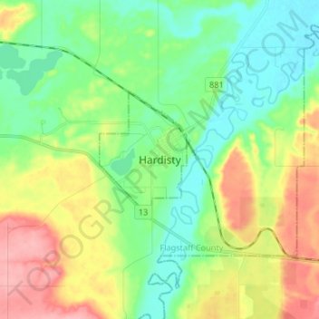
Name: Hardisty topographic map, elevation, terrain.
Location: Hardisty, Town of Hardisty, Alberta, T0B 1V0, Canada (52.62960 -111.34938 52.70960 -111.26938)
Average elevation: 639 m
Minimum elevation: 599 m
Maximum elevation: 709 m
Thank you for supporting this site ❤️
Make a donation
Make a donation
Gear up for your next adventure:
As an Amazon Associate, this site earns from qualifying purchases at no extra cost to you.