
Thank you for supporting this site ❤️
Make a donation
Make a donation
Gear up for your next adventure:
As an Amazon Associate, this site earns from qualifying purchases at no extra cost to you.
Kurichy topographic map
Click on the map to display elevation.
Thank you for supporting this site ❤️
Make a donation
Make a donation
Gear up for your next adventure:
As an Amazon Associate, this site earns from qualifying purchases at no extra cost to you.
About this map
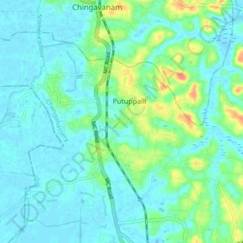
Name: Kurichy topographic map, elevation, terrain.
Location: Kurichy, Putuppalli, Changanassery, Kottayam, Kerala, India (9.47103 76.49289 9.51816 76.55753)
Average elevation: 11 m
Minimum elevation: -2 m
Maximum elevation: 51 m
Thank you for supporting this site ❤️
Make a donation
Make a donation
Gear up for your next adventure:
As an Amazon Associate, this site earns from qualifying purchases at no extra cost to you.