Geolocate

Narva topographic map

Click on the map to display elevation.

About this map

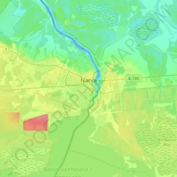
Name: Narva topographic map, elevation, terrain.

Location: Narva, Narva linn, Ida-Viru County, Estonia (59.29520 28.01129 59.44386 28.20904)

Average elevation: 21 m

Minimum elevation: -1 m

Maximum elevation: 72 m

Other topographic maps

Click on a map to view its topography, its elevation and its terrain.

Gear up for your next adventure:

🔦Everyday Carry Torches - Reliable backup light for your hiking pack
🥽UV Protection Sunglasses - Protect eyes on bright days
💧Portable Water Filters - Safe drinking water from streams and lakes
🧭Hiking Compasses - Reliable compasses for navigation off‑trail
🏕️Camping Chairs - Comfortable outdoor chairs for campsites

As an Amazon Associate, this site earns from qualifying purchases at no extra cost to you.