Geolocate

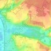
Olivet topographic map

Click on the map to display elevation.

About this map
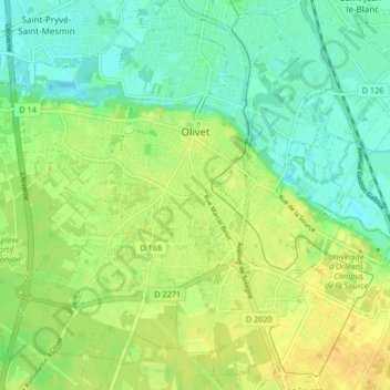
Name: Olivet topographic map, elevation, terrain.

Location: Olivet, Orléans, Loiret, Centre-Val de Loire, Metropolitan France, 45160, France (47.83182 1.84974 47.88005 1.93279)

Average elevation: 102 m

Minimum elevation: 90 m

Maximum elevation: 114 m

Other topographic maps

Click on a map to view its topography, its elevation and its terrain.

L' Île Arrault

France > Centre-Val de Loire > Loiret > Orléans

Average elevation: 102 m

La Motte Pétrée

France > Centre-Val de Loire > Loiret > Saran

Average elevation: 123 m

Le Village

France > Centre-Val de Loire > Loiret > Chevannes

Average elevation: 114 m

Au Bois d'Eau

France > Centre-Val de Loire > Loiret > Bricy

Average elevation: 123 m

Rougement

France > Centre-Val de Loire > Loiret > Loury

Average elevation: 124 m

Les Allots

France > Centre-Val de Loire > Loiret > Sandillon

Average elevation: 100 m

Gear up for your next adventure:

🥾Hiking Boots - Top hiking boots for Irish trails and rugged terrain
⛷️Mountain Sports Accessories - Gear for high intensity outdoor sports
🔋Rechargeable Batteries - Eco-friendly power for headlamps and GPS units
💳Travel Cards for Ireland - Convenient payment abroad
🧿Weather Radios - Track weather in remote places

As an Amazon Associate, this site earns from qualifying purchases at no extra cost to you.