
Thank you for supporting this site ❤️
Make a donation
Make a donation
Gear up for your next adventure:
As an Amazon Associate, this site earns from qualifying purchases at no extra cost to you.
Calacoto topographic map
Click on the map to display elevation.
Thank you for supporting this site ❤️
Make a donation
Make a donation
Gear up for your next adventure:
As an Amazon Associate, this site earns from qualifying purchases at no extra cost to you.
About this map
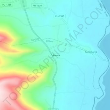
Name: Calacoto topographic map, elevation, terrain.
Location: Calacoto, Copani, Yunguyo, Puno, Perú (-16.36630 -69.06265 -16.32630 -69.02265)
Average elevation: 3,888 m
Minimum elevation: 3,810 m
Maximum elevation: 4,169 m
Thank you for supporting this site ❤️
Make a donation
Make a donation
Gear up for your next adventure:
As an Amazon Associate, this site earns from qualifying purchases at no extra cost to you.