Geolocate

Simbu topographic map

Interactive map

Click on the map to display elevation.

About this map

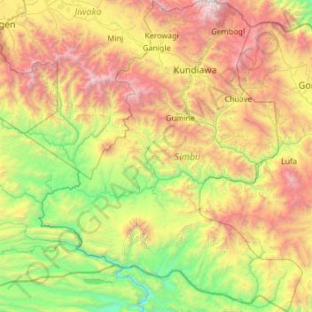
Name: Simbu topographic map, elevation, terrain.

Location: Simbu, Highlands Region, Papua New Guinea (-6.86874 144.42120 -5.77635 145.35042)

Average elevation: 1,573 m

Minimum elevation: 112 m

Maximum elevation: 4,451 m

Other topographic maps

Click on a map to view its topography, its elevation and its terrain.

Tarawai Island

Papua New Guinea > East Sepik

Average elevation: 2 m

Keas

Papua New Guinea > Enga

Average elevation: 2,132 m

Mount Suckling

Papua New Guinea > Oro

Average elevation: 3,298 m

Pender Island

Papua New Guinea > Milne Bay

Average elevation: 2 m

Wewak District

Papua New Guinea > East Sepik

Average elevation: 63 m

Laytown

Papua New Guinea > Western > Laytown

Average elevation: 704 m