
Make a donation
Gear up for your next adventure:
As an Amazon Associate, this site earns from qualifying purchases at no extra cost to you.
Marcinek topographic map
Click on the map to display elevation.
Make a donation
Gear up for your next adventure:
As an Amazon Associate, this site earns from qualifying purchases at no extra cost to you.
About this map
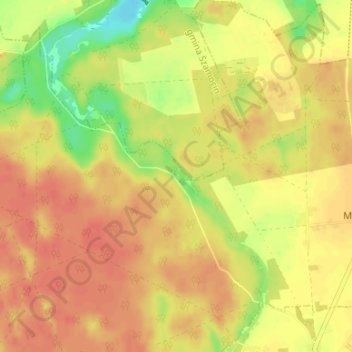
Name: Marcinek topographic map, elevation, terrain.
Average elevation: 90 m
Minimum elevation: 58 m
Maximum elevation: 107 m
Make a donation
Gear up for your next adventure:
As an Amazon Associate, this site earns from qualifying purchases at no extra cost to you.
Other topographic maps
Click on a map to view its topography, its elevation and its terrain.
Chodzież
Poland > Greater Poland Voivodeship > Chodzież County
Five kilometers west of Chodzież, at the edge of the Chodzieskie lakelands, Mt. Gontyniec rises 192 meters above sea level as the highest peak in a chain of moraine hills; at the same time it has the highest elevation in northern Poland. Deep valleys and ridges covered with a 100-year-old beech forest ensure…
Average elevation: 79 m
Chodzież
Poland > Greater Poland Voivodeship > Chodzież County > Chodzież
Five kilometers west of Chodzież, at the edge of the Chodzieskie lakelands, Mt. Gontyniec rises 192 meters above sea level as the highest peak in a chain of moraine hills; at the same time it has the highest elevation in northern Poland. Deep valleys and ridges covered with a 100-year-old beech forest ensure…
Average elevation: 78 m