Geolocate

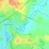
Patterdown topographic map

Click on the map to display elevation.

About this map

Name: Patterdown topographic map, elevation, terrain.

Location: Patterdown, Chippenham, Wiltshire, England, SN15 2NR, United Kingdom (51.42935 -2.15318 51.46935 -2.11318)

Average elevation: 65 m

Minimum elevation: 39 m

Maximum elevation: 109 m

Other topographic maps

Click on a map to view its topography, its elevation and its terrain.
Monkton Park

United Kingdom > England > Wiltshire > Chippenham

Average elevation: 59 m

Gear up for your next adventure:

🔦UV Flashlights - Search for minerals or inspect maps at night
🔥Compact Camping Stoves - Fast-boil stoves for trail-side meals and coffee
🧿Weather Radios - Track weather in remote places
🌍Travel Adapters - Adapters for international travel
🛌3-Season Sleeping Bags - Comfortable insulation for Irish spring and autumn nights

As an Amazon Associate, this site earns from qualifying purchases at no extra cost to you.