
Thank you for supporting this site ❤️
Make a donation
Make a donation
Gear up for your next adventure:
As an Amazon Associate, this site earns from qualifying purchases at no extra cost to you.
Choodasandra topographic map
Click on the map to display elevation.
Thank you for supporting this site ❤️
Make a donation
Make a donation
Gear up for your next adventure:
As an Amazon Associate, this site earns from qualifying purchases at no extra cost to you.
About this map
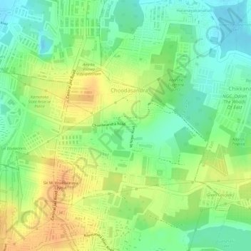
Name: Choodasandra topographic map, elevation, terrain.
Location: Choodasandra, Anekal, Bengaluru Urban, Karnataka, India (12.88239 77.67233 12.89429 77.68909)
Average elevation: 903 m
Minimum elevation: 884 m
Maximum elevation: 920 m
Thank you for supporting this site ❤️
Make a donation
Make a donation
Gear up for your next adventure:
As an Amazon Associate, this site earns from qualifying purchases at no extra cost to you.