
Thank you for supporting this site ❤️
Make a donation
Make a donation
Gear up for your next adventure:
As an Amazon Associate, this site earns from qualifying purchases at no extra cost to you.
Straumsbotn topographic map
Click on the map to display elevation.
Thank you for supporting this site ❤️
Make a donation
Make a donation
Gear up for your next adventure:
As an Amazon Associate, this site earns from qualifying purchases at no extra cost to you.
About this map
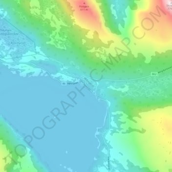
Name: Straumsbotn topographic map, elevation, terrain.
Location: Straumsbotn, Senja, Troms og Finnmark, Norway (69.36960 17.37762 69.40960 17.41762)
Average elevation: 152 m
Minimum elevation: -1 m
Maximum elevation: 769 m
Thank you for supporting this site ❤️
Make a donation
Make a donation
Gear up for your next adventure:
As an Amazon Associate, this site earns from qualifying purchases at no extra cost to you.