
Gray Wolf Glacier topographic map
Interactive map
Click on the map to display elevation.
About this map
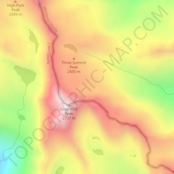
Name: Gray Wolf Glacier topographic map, elevation, terrain.
Location: Gray Wolf Glacier, Missoula, United States of America (47.29099 -113.86654 47.29109 -113.86644)
Average elevation: 2,299 m
Minimum elevation: 1,735 m
Maximum elevation: 2,728 m