
Kota Baharu topographic map
Interactive map
Click on the map to display elevation.
About this map
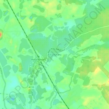
Name: Kota Baharu topographic map, elevation, terrain.
Location: Kota Baharu, Kampar, Perak, Malaysia (4.38329 101.06505 4.42329 101.10505)
Average elevation: 21 m
Minimum elevation: 7 m
Maximum elevation: 41 m
Other topographic maps
Click on a map to view its topography, its elevation and its terrain.