
Thank you for supporting this site ❤️
Make a donation
Make a donation
Gear up for your next adventure:
As an Amazon Associate, this site earns from qualifying purchases at no extra cost to you.
Naranjillo topographic map
Click on the map to display elevation.
Thank you for supporting this site ❤️
Make a donation
Make a donation
Gear up for your next adventure:
As an Amazon Associate, this site earns from qualifying purchases at no extra cost to you.
About this map
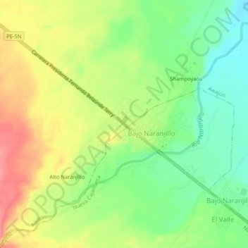
Name: Naranjillo topographic map, elevation, terrain.
Location: Naranjillo, Awajún, Rioja, San Martín, Perú (-5.82395 -77.42084 -5.78395 -77.38084)
Average elevation: 891 m
Minimum elevation: 852 m
Maximum elevation: 937 m
Thank you for supporting this site ❤️
Make a donation
Make a donation
Gear up for your next adventure:
As an Amazon Associate, this site earns from qualifying purchases at no extra cost to you.