
La Cuchilla topographic map
Interactive map
Click on the map to display elevation.
About this map
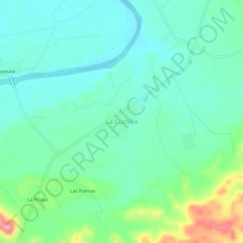
Name: La Cuchilla topographic map, elevation, terrain.
Location: La Cuchilla, Tamazunchale, San Luis Potosí, México (21.26496 -98.74556 21.30496 -98.70556)
Average elevation: 119 m
Minimum elevation: 93 m
Maximum elevation: 194 m
Other topographic maps
Click on a map to view its topography, its elevation and its terrain.
Tamazunchale
México > San Luis Potosí > Tamazunchale
Tamazunchale, San Luis Potosí, México
Average elevation: 284 m