
Wootton Bridge topographic map
Interactive map
Click on the map to display elevation.
About this map
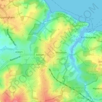
Name: Wootton Bridge topographic map, elevation, terrain.
Location: Wootton Bridge, Isle of Wight, England, United Kingdom (50.70432 -1.25813 50.74777 -1.21087)
Average elevation: 26 m
Minimum elevation: -6 m
Maximum elevation: 76 m
Other topographic maps
Click on a map to view its topography, its elevation and its terrain.