Geolocate

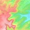
Orval topographic map

Click on the map to display elevation.

About this map

Name: Orval topographic map, elevation, terrain.

Location: Orval, Saint-Amand-Montrond, Cher, Centre-Val de Loire, Metropolitan France, 18200, France (46.70691 2.44444 46.73905 2.49076)

Average elevation: 165 m

Minimum elevation: 148 m

Maximum elevation: 211 m

Other topographic maps

Click on a map to view its topography, its elevation and its terrain.

Les Houards

France > Centre-Val de Loire > Cher > Le Grouzeau

Average elevation: 157 m

Ivry

France > Centre-Val de Loire > Cher > Vasselay

Average elevation: 159 m

Chavignol

France > Centre-Val de Loire > Cher > Amigny

Average elevation: 282 m

La Garde de Dieu

France > Centre-Val de Loire > Cher > Culan

Average elevation: 276 m

Crux

France > Centre-Val de Loire > Cher > Villequiers

Average elevation: 196 m

Bertrix

France > Centre-Val de Loire > Cher > Clémont

Average elevation: 148 m

Gear up for your next adventure:

👖Zip-off Hiking Pants - Adapt to changing Irish temperatures quickly
🛸Lightweight Camera Drones - Capture stunning aerial topographic views of the landscape
🎒Backpack Rain Covers - Extra protection for non-waterproof rucksacks
🍁Eco‑Friendly Outdoor Products - Sustainable outdoor gear
🧺Waterproof Picnic Blankets - Dry seating for breaks on damp grass

As an Amazon Associate, this site earns from qualifying purchases at no extra cost to you.