
San José topographic map
Interactive map
Click on the map to display elevation.
About this map
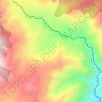
Name: San José topographic map, elevation, terrain.
Location: San José, Recetor, Casanare, RAP Llanos, Colombia (5.28695 -72.77029 5.33686 -72.71786)
Average elevation: 1,468 m
Minimum elevation: 834 m
Maximum elevation: 1,992 m
Other topographic maps
Click on a map to view its topography, its elevation and its terrain.