
Vancouver topographic map
Interactive map
Click on the map to display elevation.
About this map
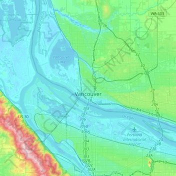
Name: Vancouver topographic map, elevation, terrain.
Location: Vancouver, Clark County, Washington, United States (45.57739 -122.77456 45.69800 -122.46456)
Average elevation: 54 m
Minimum elevation: -4 m
Maximum elevation: 358 m