
Caucasus Mountains topographic map
Interactive map
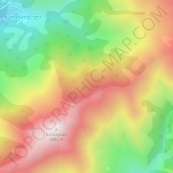
Click on the map to display elevation.
About this map
Name: Caucasus Mountains topographic map, elevation, terrain.
Average elevation: 2,188 m
Minimum elevation: 1,678 m
Maximum elevation: 2,683 m
Other topographic maps
Click on a map to view its topography, its elevation and its terrain.
Stepantsminda
Georgia > Mtskheta-Mtianeti > Kazbegi Municipality
The town is located along the banks of the Terek River, 157 kilometers (98 mi) to the north of Tbilisi at an elevation of 1,740 meters (5,710 feet) above sea level. Stepantsminda’s climate is moderately humid with relatively dry, cold winters and long and cool summers. The average annual temperature is 4.9…
Average elevation: 1,851 m