Geolocate

Berkeley topographic map

Click on the map to display elevation.

About this map

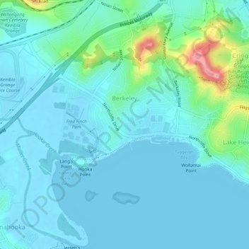
Name: Berkeley topographic map, elevation, terrain.

Location: Berkeley, Wollongong City Council, New South Wales, 2506, Australia (-34.50107 150.82406 -34.46207 150.86423)

Average elevation: 18 m

Minimum elevation: -1 m

Maximum elevation: 118 m

Other topographic maps

Click on a map to view its topography, its elevation and its terrain.

Gear up for your next adventure:

🎁Outdoor Gift Ideas - Great gifts for adventurers
🚲Cycling GPS Computers - Topographic mapping for Irish road and mountain biking
🥽UV Protection Sunglasses - Protect eyes on bright days
🧤Thermal Gloves - Warm gloves for cold weather
🪵Fire Starters & Tools - Tools to start fire in wet conditions

As an Amazon Associate, this site earns from qualifying purchases at no extra cost to you.