
Bishkek City topographic map
Interactive map
Click on the map to display elevation.
Bishkek City
Bishkek is situated at an altitude of about 800 metres (2,600 ft), just off the northern fringe of the Kyrgyz Ala-Too Range, an extension of the Tian Shan mountain range. These mountains rise to a height of 4,895 metres (16,060 ft). North of the city, a fertile and gently undulating steppe extends far north into neighboring Kazakhstan. The river Chüy drains most of the area. Bishkek is connected to the Turkestan–Siberia Railway by a spur line.
About this map
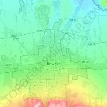
Name: Bishkek City topographic map, elevation, terrain.
Location: Bishkek City, Kyrgyzstan (42.78511 74.45489 43.01250 74.71772)
Average elevation: 755 m
Minimum elevation: 628 m
Maximum elevation: 1,270 m
Other topographic maps
Click on a map to view its topography, its elevation and its terrain.