
Dooncarton topographic map
Interactive map
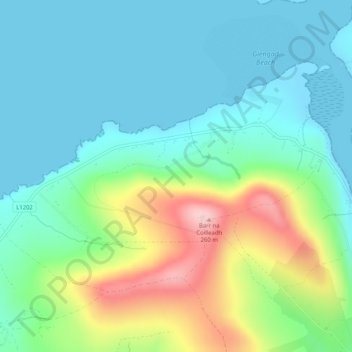
Click on the map to display elevation.
About this map
Name: Dooncarton topographic map, elevation, terrain.
Average elevation: 71 m
Minimum elevation: 0 m
Maximum elevation: 264 m
County Mayo trails, hiking, mountain biking, running and outdoor activities
Other topographic maps
Click on a map to view its topography, its elevation and its terrain.
Nephin
In Leabhar Fiachrach, a topographical and genealogical tract written by Giolla Iosa Mor Mac Fhirbhisigh about 1400, the areas early peoples and families are listed thus.
Average elevation: 404 m