
公園 topographic map
Interactive map
Click on the map to display elevation.
About this map
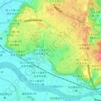
Name: 公園 topographic map, elevation, terrain.
Location: 公園, 御所野ニュータウン, 四ツ小屋末戸松本字坂ノ上, 秋田市, 秋田县, 日本 (39.65651 140.16323 39.65689 140.16354)
Average elevation: 26 m
Minimum elevation: 1 m
Maximum elevation: 64 m