
Dorfgastein topographic map
Interactive map
Click on the map to display elevation.
About this map
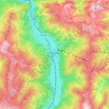
Name: Dorfgastein topographic map, elevation, terrain.
Location: Dorfgastein, Salzburg, 5632, Austria (47.19286 13.04037 47.28823 13.15509)
Average elevation: 1,506 m
Minimum elevation: 745 m
Maximum elevation: 2,326 m
Other topographic maps
Click on a map to view its topography, its elevation and its terrain.