
Thank you for supporting this site ❤️
Make a donation
Make a donation
Gear up for your next adventure:
As an Amazon Associate, this site earns from qualifying purchases at no extra cost to you.
Gentam topographic map
Click on the map to display elevation.
Thank you for supporting this site ❤️
Make a donation
Make a donation
Gear up for your next adventure:
As an Amazon Associate, this site earns from qualifying purchases at no extra cost to you.
About this map
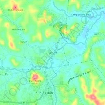
Name: Gentam topographic map, elevation, terrain.
Location: Gentam, Kuala Pilah, Negeri Sembilan, 72000, Malaysia (2.73402 102.23027 2.77402 102.27027)
Average elevation: 99 m
Minimum elevation: 70 m
Maximum elevation: 170 m
Thank you for supporting this site ❤️
Make a donation
Make a donation
Gear up for your next adventure:
As an Amazon Associate, this site earns from qualifying purchases at no extra cost to you.