
Thank you for supporting this site ❤️
Make a donation
Make a donation
Gear up for your next adventure:
As an Amazon Associate, this site earns from qualifying purchases at no extra cost to you.
Occobamba topographic map
Click on the map to display elevation.
Thank you for supporting this site ❤️
Make a donation
Make a donation
Gear up for your next adventure:
As an Amazon Associate, this site earns from qualifying purchases at no extra cost to you.
About this map
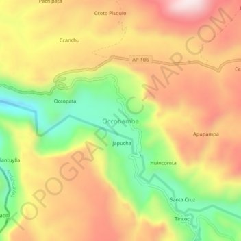
Name: Occobamba topographic map, elevation, terrain.
Location: Occobamba, Pampachiri, Andahuaylas, Apurímac, Perú (-14.25104 -73.51978 -14.21104 -73.47978)
Average elevation: 3,660 m
Minimum elevation: 3,390 m
Maximum elevation: 3,896 m
Thank you for supporting this site ❤️
Make a donation
Make a donation
Gear up for your next adventure:
As an Amazon Associate, this site earns from qualifying purchases at no extra cost to you.