
Bagong Sikat topographic map
Interactive map
Click on the map to display elevation.
About this map
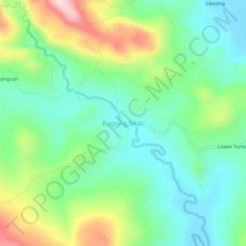
Name: Bagong Sikat topographic map, elevation, terrain.
Location: Bagong Sikat, Oriental Mindoro, Mimaropa, Philippines (12.32585 121.27539 12.36585 121.31539)
Average elevation: 120 m
Minimum elevation: 18 m
Maximum elevation: 337 m
Other topographic maps
Click on a map to view its topography, its elevation and its terrain.
Bansud
Philippines > Oriental Mindoro
Bansud, Oriental Mindoro, Mimaropa, Philippines
Average elevation: 20 m
Tacligan
Philippines > Oriental Mindoro > San Teodoro
Tacligan, San Teodoro, Oriental Mindoro, Mimaropa, 5202, Philippines
Average elevation: 19 m
Bongabong River
Philippines > Oriental Mindoro > Lisap
Bongabong River, Lisap, Oriental Mindoro, Mimaropa, 5211, Philippines
Average elevation: 81 m
Tibag
Philippines > Oriental Mindoro > Calapan
Tibag, Calapan, Oriental Mindoro, Mimaropa, Philippines
Average elevation: 5 m
Sinandigan
Philippines > Oriental Mindoro > Puerto Galera > Sabang
Sinandigan, Sabang, Puerto Galera, Oriental Mindoro, Mimaropa, 5221, Philippines
Average elevation: 7 m
Suki
Philippines > Oriental Mindoro > Calapan > Bulusan
Suki, Bulusan, Calapan, Oriental Mindoro, Mimaropa, 5200, Philippines
Average elevation: 21 m
Baco
Philippines > Oriental Mindoro
Baco, Oriental Mindoro, Mimaropa, Philippines
Average elevation: 14 m
Gloria
Philippines > Oriental Mindoro
Gloria, Oriental Mindoro, Mimaropa, 5213, Philippines
Average elevation: 12 m
Mansalay
Philippines > Oriental Mindoro
Mansalay, Oriental Mindoro, Mimaropa, Philippines
Average elevation: 58 m
Balatero
Philippines > Oriental Mindoro > Puerto Galera
Balatero, Puerto Galera, Oriental Mindoro, Mimaropa, 5221, Philippines
Average elevation: 51 m
Tigkan
Philippines > Oriental Mindoro
Tigkan, Oriental Mindoro, Mimaropa, Philippines
Average elevation: 16 m
Santa Isabel
Philippines > Oriental Mindoro > Calapan
Santa Isabel, Calapan, Oriental Mindoro, Mimaropa, 5200, Philippines
Average elevation: 6 m
Leuteboro I
Philippines > Oriental Mindoro
Leuteboro I, Oriental Mindoro, Mimaropa, 5207, Philippines
Average elevation: 16 m
Naujan Lake
Philippines > Oriental Mindoro > Malabo
Naujan Lake, Malabo, Oriental Mindoro, Mimaropa, Philippines
Average elevation: 46 m
Guinobatan
Philippines > Oriental Mindoro > Calapan
Guinobatan, Calapan, Oriental Mindoro, Mimaropa, 5200, Philippines
Average elevation: 25 m
Calapan
Philippines > Oriental Mindoro
Calapan, Oriental Mindoro, Mimaropa, 5200, Philippines
Average elevation: 40 m
Wasig
Philippines > Oriental Mindoro
Wasig, Oriental Mindoro, Mimaropa, Philippines
Average elevation: 3 m
Calapan
Philippines > Oriental Mindoro
Calapan, Oriental Mindoro, Mimaropa, 5200, Philippines
Average elevation: 12 m
Malaya
Philippines > Oriental Mindoro > Bansud
Malaya, Bansud, Oriental Mindoro, Mimaropa, Philippines
Average elevation: 11 m
Parang
Philippines > Oriental Mindoro > San Teodoro
Parang, San Teodoro, Oriental Mindoro, Mimaropa, 5202, Philippines
Average elevation: 19 m
Lumangbayan
Philippines > Oriental Mindoro > San Teodoro
Lumangbayan, San Teodoro, Oriental Mindoro, Mimaropa, 5202, Philippines
Average elevation: 25 m
Poblacion
Philippines > Oriental Mindoro > San Teodoro
Poblacion, San Teodoro, Oriental Mindoro, Mimaropa, 5202, Philippines
Average elevation: 22 m
Bayanan II
Philippines > Oriental Mindoro > Calapan
Bayanan II, Calapan, Oriental Mindoro, Mimaropa, Philippines
Average elevation: 8 m
Lisap
Philippines > Oriental Mindoro
Lisap, Oriental Mindoro, Mimaropa, 5211, Philippines
Average elevation: 194 m
Hagan
Philippines > Oriental Mindoro
Hagan, Oriental Mindoro, Mimaropa, 5211, Philippines
Average elevation: 184 m
Lalud
Philippines > Oriental Mindoro > Calapan > Guinobatan
Lalud, Guinobatan, Calapan, Oriental Mindoro, Mimaropa, Philippines
Average elevation: 8 m
Santo Niño
Philippines > Oriental Mindoro > Puerto Galera
Santo Niño, Puerto Galera, Oriental Mindoro, Mimaropa, Philippines
Average elevation: 44 m
Calsapa
Philippines > Oriental Mindoro > San Teodoro
Calsapa, San Teodoro, Oriental Mindoro, Mimaropa, Philippines
Average elevation: 79 m
Communal
Philippines > Oriental Mindoro > Calapan
Communal, Calapan, Oriental Mindoro, Mimaropa, Philippines
Average elevation: 14 m
Naujan
Philippines > Oriental Mindoro
Naujan, Oriental Mindoro, Mimaropa, 5204, Philippines
Average elevation: 4 m
Maujao
Philippines > Oriental Mindoro
Maujao, Oriental Mindoro, Mimaropa, Philippines
Average elevation: 23 m
Bulusan
Philippines > Oriental Mindoro > Calapan
Bulusan, Calapan, Oriental Mindoro, Mimaropa, 5200, Philippines
Average elevation: 33 m
Naujan
Philippines > Oriental Mindoro > Calapan
Naujan, Calapan, Oriental Mindoro, Mimaropa, Philippines
Average elevation: 252 m
Odiong
Philippines > Oriental Mindoro
Odiong, Oriental Mindoro, Mimaropa, Philippines
Average elevation: 12 m
Magindat
Philippines > Oriental Mindoro > Calapan
Magindat, Calapan, Oriental Mindoro, Mimaropa, Philippines
Average elevation: 10 m
Alcate
Philippines > Oriental Mindoro
Alcate, Oriental Mindoro, Mimaropa, Philippines
Average elevation: 56 m
Morente
Philippines > Oriental Mindoro
Morente, Oriental Mindoro, Mimaropa, 5211, Philippines
Average elevation: 167 m
Nazareto
Philippines > Oriental Mindoro > Calapan
Nazareto, Lazareto, Oriental Mindoro, Mimaropa, 5200, Philippines
Average elevation: 7 m
Masagana
Philippines > Oriental Mindoro
Masagana, Oriental Mindoro, Mimaropa, Philippines
Average elevation: 58 m
Silonay
Philippines > Oriental Mindoro > Silonay
Silonay, Oriental Mindoro, Mimaropa, 5200, Philippines
Average elevation: 14 m
Puerto Galera
Philippines > Oriental Mindoro
Puerto Galera, Oriental Mindoro, Mimaropa, 5221, Philippines
Average elevation: 442 m
Sapul
Philippines > Oriental Mindoro
Sapul, Oriental Mindoro, Mimaropa, 5200, Philippines
Average elevation: 15 m
Alcadesma
Philippines > Oriental Mindoro > Alcadesma
Alcadesma, Oriental Mindoro, Mimaropa, Philippines
Average elevation: 14 m
Malugay
Philippines > Oriental Mindoro > Malugay
Malugay, Oriental Mindoro, Mimaropa, Philippines
Average elevation: 53 m
Puting Tubig
Philippines > Oriental Mindoro > Puting Tubig
Puting Tubig, Oriental Mindoro, Mimaropa, Philippines
Average elevation: 10 m
San Isidro
Philippines > Oriental Mindoro > Puerto Galera
San Isidro, Puerto Galera, Oriental Mindoro, Mimaropa, 5221, Philippines
Average elevation: 55 m
Puerto Galera
Philippines > Oriental Mindoro > Puerto Galera
Puerto Galera, Oriental Mindoro, Mimaropa, Philippines
Average elevation: 81 m
Medio Island
Philippines > Oriental Mindoro > Puerto Galera > Coco Beach
Medio Island, Coco Beach, Puerto Galera, Oriental Mindoro, Mimaropa, Philippines
Average elevation: 7 m
Bagumbayan II
Philippines > Oriental Mindoro > Bongabong
Bagumbayan II, Bongabong, Oriental Mindoro, Mimaropa, 5211, Philippines
Average elevation: 6 m
Bonbon
Philippines > Oriental Mindoro > Calapan > Lazareto
Bonbon, Lazareto, Calapan, Oriental Mindoro, Mimaropa, 5200, Philippines
Average elevation: 14 m