
Thank you for supporting this site ❤️
Make a donation
Make a donation
Gear up for your next adventure:
As an Amazon Associate, this site earns from qualifying purchases at no extra cost to you.
Kangari topographic map
Click on the map to display elevation.
Thank you for supporting this site ❤️
Make a donation
Make a donation
Gear up for your next adventure:
As an Amazon Associate, this site earns from qualifying purchases at no extra cost to you.
About this map
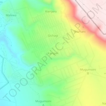
Name: Kangari topographic map, elevation, terrain.
Location: Kangari, Malewa West ward, Gilgil, Nakuru, Rift Valley, Kenya (-0.65445 36.42958 -0.61445 36.46958)
Average elevation: 2,134 m
Minimum elevation: 1,922 m
Maximum elevation: 2,457 m
Thank you for supporting this site ❤️
Make a donation
Make a donation
Gear up for your next adventure:
As an Amazon Associate, this site earns from qualifying purchases at no extra cost to you.