
Thank you for supporting this site ❤️
Make a donation
Make a donation
Gear up for your next adventure:
As an Amazon Associate, this site earns from qualifying purchases at no extra cost to you.
Kitzbühel topographic map
Click on the map to display elevation.
Thank you for supporting this site ❤️
Make a donation
Make a donation
Gear up for your next adventure:
As an Amazon Associate, this site earns from qualifying purchases at no extra cost to you.
About this map
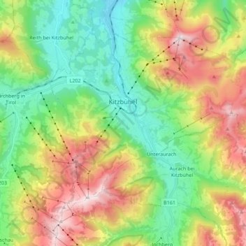
Name: Kitzbühel topographic map, elevation, terrain.
Location: Kitzbühel, Bezirk Kitzbühel, Tyrol, 6370, Austria (47.39505 12.34109 47.47793 12.50914)
Average elevation: 1,176 m
Minimum elevation: 692 m
Maximum elevation: 1,974 m
Thank you for supporting this site ❤️
Make a donation
Make a donation
Gear up for your next adventure:
As an Amazon Associate, this site earns from qualifying purchases at no extra cost to you.