
Muskogee topographic map
Interactive map
Click on the map to display elevation.
About this map
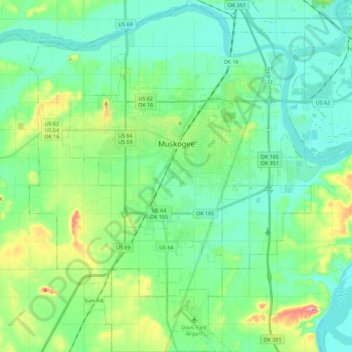
Name: Muskogee topographic map, elevation, terrain.
Location: Muskogee, Muskogee County, Oklahoma, Stati Uniti d'America (35.63865 -95.46477 35.82257 -95.27636)
Average elevation: 176 m
Minimum elevation: 145 m
Maximum elevation: 272 m