
Allen County topographic map
Interactive map
Click on the map to display elevation.
About this map
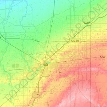
Name: Allen County topographic map, elevation, terrain.
Location: Allen County, Ohio, United States (40.64266 -84.39757 40.92043 -83.87984)
Average elevation: 264 m
Minimum elevation: 221 m
Maximum elevation: 336 m