
Thank you for supporting this site ❤️
Make a donation
Make a donation
Gear up for your next adventure:
As an Amazon Associate, this site earns from qualifying purchases at no extra cost to you.
Nyamonye topographic map
Click on the map to display elevation.
Thank you for supporting this site ❤️
Make a donation
Make a donation
Gear up for your next adventure:
As an Amazon Associate, this site earns from qualifying purchases at no extra cost to you.
About this map
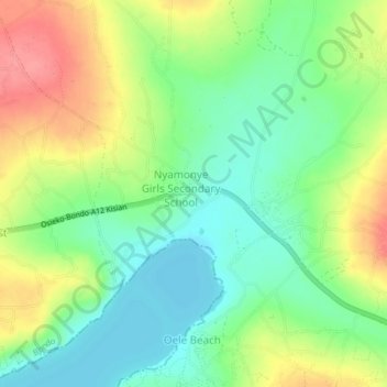
Name: Nyamonye topographic map, elevation, terrain.
Location: Nyamonye, Yimbo East ward, Bondo, Siaya County, Kenya (-0.07003 34.12179 -0.03003 34.16179)
Average elevation: 1,164 m
Minimum elevation: 1,132 m
Maximum elevation: 1,210 m
Thank you for supporting this site ❤️
Make a donation
Make a donation
Gear up for your next adventure:
As an Amazon Associate, this site earns from qualifying purchases at no extra cost to you.