
Thank you for supporting this site ❤️
Make a donation
Make a donation
Gear up for your next adventure:
As an Amazon Associate, this site earns from qualifying purchases at no extra cost to you.
Potrerillos topographic map
Click on the map to display elevation.
Thank you for supporting this site ❤️
Make a donation
Make a donation
Gear up for your next adventure:
As an Amazon Associate, this site earns from qualifying purchases at no extra cost to you.
About this map
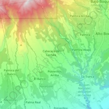
Name: Potrerillos topographic map, elevation, terrain.
Location: Potrerillos, Distrito Dolega, Chiriquí, Panama (8.64911 -82.52938 8.77737 -82.44996)
Average elevation: 1,113 m
Minimum elevation: 488 m
Maximum elevation: 2,596 m
Thank you for supporting this site ❤️
Make a donation
Make a donation
Gear up for your next adventure:
As an Amazon Associate, this site earns from qualifying purchases at no extra cost to you.