
Burekup topographic map
Interactive map
Click on the map to display elevation.
About this map
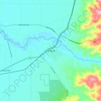
Name: Burekup topographic map, elevation, terrain.
Location: Burekup, Western Australia, 6227, Australia (-33.35065 115.77053 -33.27065 115.85053)
Average elevation: 43 m
Minimum elevation: 2 m
Maximum elevation: 235 m
Other topographic maps
Click on a map to view its topography, its elevation and its terrain.
Roelands
Australia > Western Australia > Burekup > Roelands
Roelands, Burekup, Western Australia, 6227, Australia
Average elevation: 47 m