
Thank you for supporting this site ❤️
Make a donation
Make a donation
Gear up for your next adventure:
As an Amazon Associate, this site earns from qualifying purchases at no extra cost to you.
Easdale topographic map
Click on the map to display elevation.
Thank you for supporting this site ❤️
Make a donation
Make a donation
Gear up for your next adventure:
As an Amazon Associate, this site earns from qualifying purchases at no extra cost to you.
About this map
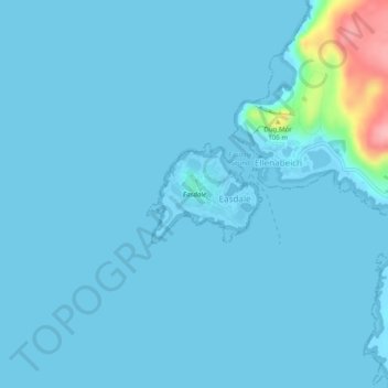
Name: Easdale topographic map, elevation, terrain.
Location: Easdale, Argyll and Bute, Scotland, PA34 4TB, United Kingdom (56.28900 -5.66467 56.29517 -5.65178)
Average elevation: 8 m
Minimum elevation: -2 m
Maximum elevation: 127 m
Thank you for supporting this site ❤️
Make a donation
Make a donation
Gear up for your next adventure:
As an Amazon Associate, this site earns from qualifying purchases at no extra cost to you.