
Thank you for supporting this site ❤️
Make a donation
Make a donation
Gear up for your next adventure:
As an Amazon Associate, this site earns from qualifying purchases at no extra cost to you.
Obereggen topographic map
Click on the map to display elevation.
Thank you for supporting this site ❤️
Make a donation
Make a donation
Gear up for your next adventure:
As an Amazon Associate, this site earns from qualifying purchases at no extra cost to you.
About this map
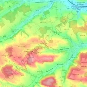
Name: Obereggen topographic map, elevation, terrain.
Location: Obereggen, Meggenhofen, Bezirk Grieskirchen, 4714, Austria (48.13888 13.79536 48.17888 13.83536)
Average elevation: 419 m
Minimum elevation: 354 m
Maximum elevation: 484 m
Thank you for supporting this site ❤️
Make a donation
Make a donation
Gear up for your next adventure:
As an Amazon Associate, this site earns from qualifying purchases at no extra cost to you.