
Thank you for supporting this site ❤️
Make a donation
Make a donation
Gear up for your next adventure:
As an Amazon Associate, this site earns from qualifying purchases at no extra cost to you.
Libarna topographic map
Click on the map to display elevation.
Thank you for supporting this site ❤️
Make a donation
Make a donation
Gear up for your next adventure:
As an Amazon Associate, this site earns from qualifying purchases at no extra cost to you.
About this map
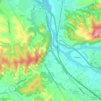
Name: Libarna topographic map, elevation, terrain.
Location: Libarna, Serravalle Scrivia, Alessandria, Piedmont, 15069, Italy (44.68990 8.84072 44.72990 8.88072)
Average elevation: 268 m
Minimum elevation: 188 m
Maximum elevation: 444 m
Thank you for supporting this site ❤️
Make a donation
Make a donation
Gear up for your next adventure:
As an Amazon Associate, this site earns from qualifying purchases at no extra cost to you.