

Freising topographic map
Click on the map to display elevation.
Freising
In 1802/1803 Bavaria fell under the influence of Napoleonic France in which church controlled lands were secularized. In Freising, the more than thousand-year-old bishopric was abolished. The Roman Catholic Church lost most of its properties and authority over the city. Though the seat of the diocese was moved to Munich in 1821, including the elevation to an archdiocese, Freising has remained the seat of diocesan administration until today.
About this map
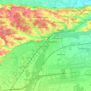
Name: Freising topographic map, elevation, terrain.
Location: Freising, Landkreis Freising, Bavaria, Germany (48.33061 11.64045 48.44903 11.79251)
Average elevation: 457 m
Minimum elevation: 419 m
Maximum elevation: 522 m