Geolocate

Provincia di Imperia topographic map

Click on the map to display elevation.

Gear up for your next adventure:

As an Amazon Associate, this site earns from qualifying purchases at no extra cost to you.

About this map

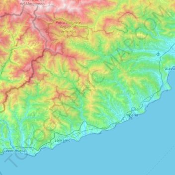
Name: Provincia di Imperia topographic map, elevation, terrain.

Location: Provincia di Imperia, Liguria, Italy (43.77569 7.49516 44.14102 8.13540)

Average elevation: 604 m

Minimum elevation: 0 m

Maximum elevation: 2,636 m

👉 Easily get elevation data in JSON, GeoTIFF and KML formats using Elevation API
Thank you for supporting this site ❤️
Make a donation

Gear up for your next adventure:

As an Amazon Associate, this site earns from qualifying purchases at no extra cost to you.

Gear up for your next adventure:

🧢Waterproof Caps - Keep rain off your face and glasses while hiking
📊Altimeters & Barometers - Track elevation and weather changes
🧊Hydration Reservoirs - Easy drinking on the move with 2L or 3L bladders

As an Amazon Associate, this site earns from qualifying purchases at no extra cost to you.