
Townsville topographic map
Interactive map
Click on the map to display elevation.
About this map
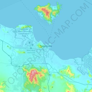
Name: Townsville topographic map, elevation, terrain.
Location: Townsville, Queensland, 4810, Australie (-19.41694 146.66395 -19.09694 146.98395)
Average elevation: 30 m
Minimum elevation: -3 m
Maximum elevation: 579 m
Other topographic maps
Click on a map to view its topography, its elevation and its terrain.
Gorge Falls
Australie > Queensland > Townsville
Gorge Falls, Townsville, Queensland, Australie
Average elevation: 240 m