
Make a donation
Gear up for your next adventure:
As an Amazon Associate, this site earns from qualifying purchases at no extra cost to you.
Sundarganj topographic map
Click on the map to display elevation.
Make a donation
Gear up for your next adventure:
As an Amazon Associate, this site earns from qualifying purchases at no extra cost to you.
About this map
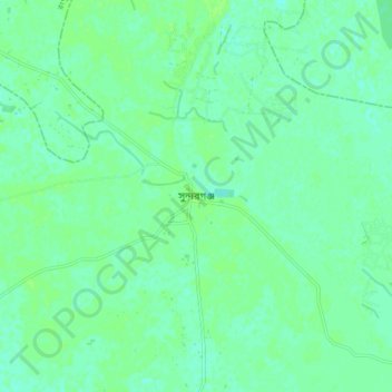
Name: Sundarganj topographic map, elevation, terrain.
Location: Sundarganj, Gaibandha District, Rangpur Division, Bangladesh (25.52697 89.48277 25.60697 89.56277)
Average elevation: 25 m
Minimum elevation: 20 m
Maximum elevation: 30 m
Make a donation
Gear up for your next adventure:
As an Amazon Associate, this site earns from qualifying purchases at no extra cost to you.
Other topographic maps
Click on a map to view its topography, its elevation and its terrain.
Saidpur Paurashava
Bangladesh > Rangpur Division > Saidpur Upazila
Saidpur is located in the Rangpur Division at Northern Bangladesh. The elevation of Saidpur is 40 meters. Most of the city and its surrounding area is made of Alluvium Flood plain. The river Khrkharia flows near the city.
Average elevation: 40 m
Nilphamari Paurashava
Bangladesh > Rangpur Division > Nilphamari Sadar Upazila
The city is situated on the Barind Tract, a slightly elevated Pleistocene terrace, with an average elevation of 45 metres (148 ft) above sea level. The terrain is generally flat, sloping gently from north to south. The highest point in the city is approximately 47 metres (154 ft), while the lowest is around 44…
Average elevation: 47 m
Boda Paurashava
Bangladesh > Rangpur Division > Boda Upazila
Boda is located in the Rangpur Division of northern Bangladesh. Boda Municipality covers a total area of 16.46 square kilometres (6.35 sq mi). The elevation of Boda is approximately 48 meters (157 ft) above sea level. The Karatoya River flows through the eastern part of the upazila. The soil is mainly composed…
Average elevation: 65 m
Make a donation
Gear up for your next adventure:
As an Amazon Associate, this site earns from qualifying purchases at no extra cost to you.
Make a donation
Gear up for your next adventure:
As an Amazon Associate, this site earns from qualifying purchases at no extra cost to you.
Make a donation
Gear up for your next adventure:
As an Amazon Associate, this site earns from qualifying purchases at no extra cost to you.
Shahapur Play Ground
Bangladesh > Rangpur Division > Badarganj Upazila > Bodorganj
Average elevation: 34 m
Make a donation
Gear up for your next adventure:
As an Amazon Associate, this site earns from qualifying purchases at no extra cost to you.
Make a donation
Gear up for your next adventure:
As an Amazon Associate, this site earns from qualifying purchases at no extra cost to you.
Make a donation
Gear up for your next adventure:
As an Amazon Associate, this site earns from qualifying purchases at no extra cost to you.