Geolocate

Test Valley topographic map

Click on the map to display elevation.

About this map

Name: Test Valley topographic map, elevation, terrain.

Location: Test Valley, Testwood, New Forest, Hampshire, England, United Kingdom (50.88057 -1.50294 50.95491 -1.39474)

Average elevation: 18 m

Minimum elevation: -4 m

Maximum elevation: 83 m

Other topographic maps

Click on a map to view its topography, its elevation and its terrain.
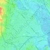
Totton

United Kingdom > England > Hampshire > New Forest > Testwood

Average elevation: 10 m

Gear up for your next adventure:

📡Satellite Messengers - Emergency communication for remote areas without signal
👣Waterproof Leg Gaiters - Keep bog water and debris out of your boots
🔋Portable Power Banks - Keep devices charged on long trips
🎒Day Packs - Perfect packs for day trips
🎧Wireless Earbuds - Music on the move

As an Amazon Associate, this site earns from qualifying purchases at no extra cost to you.