
Ilha de Santa Maria topographic map
Interactive map
Click on the map to display elevation.
Ilha de Santa Maria
On 8 February 1989, an American chartered Boeing 707 of Independent Air Flight 1851 crashed at Pico Alto, killing all 137 passengers and 7 members of the crew. There was confusion between tower and pilots as to the appropriate altitude during their approach.
About this map
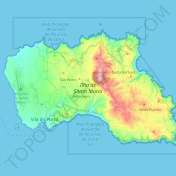
Name: Ilha de Santa Maria topographic map, elevation, terrain.
Average elevation: 81 m
Minimum elevation: -1 m
Maximum elevation: 569 m