Geolocate

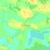
Derrywode topographic map

Click on the map to display elevation.

About this map

Name: Derrywode topographic map, elevation, terrain.

Location: Derrywode, Island ED, Ballinasloe Municipal District, County Galway, Connacht, Ireland (53.68189 -8.56242 53.69595 -8.53377)

Average elevation: 77 m

Minimum elevation: 62 m

Maximum elevation: 98 m

County Galway trails, hiking, mountain biking, running and outdoor activities

Other topographic maps

Click on a map to view its topography, its elevation and its terrain.
Gear up for your next adventure:

🕶️Polarized Sunglasses - Reduce glare outdoors
🥛Insulated Flasks - Keep drinks hot or cold
🎽Thermal Base Layers - Essential moisture management for cold weather
🩹Compact First Aid Kits - Treat blisters and minor injuries on the trail
🧯Camp Safety Kits - All‑in‑one safety gear

As an Amazon Associate, this site earns from qualifying purchases at no extra cost to you.