
Nanchang topographic map
Interactive map
Click on the map to display elevation.
About this map
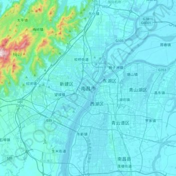
Name: Nanchang topographic map, elevation, terrain.
Location: Nanchang, 红谷滩区, Nanchang, Jiangxi, 330008, China (28.52755 115.69400 28.84755 116.01400)
Average elevation: 65 m
Minimum elevation: 10 m
Maximum elevation: 815 m
Der Stern von Nanchang[3] ist eines der größten Riesenräder der Welt (Höhe 160 m, Durchmesser 153 m; Baukosten ca. 57 Mio. Yuan (≈ 6 Mio. €); Einweihung am 2. Mai 2006).
Other topographic maps
Click on a map to view its topography, its elevation and its terrain.
Poyang-See
Poyang-See, 吴城镇, 永修县 (Yongxiu), 九江市 / Jiujiang, Jiangxi, China
Average elevation: 60 m