Geolocate

Mission Hills Ranch topographic map

Click on the map to display elevation.

About this map

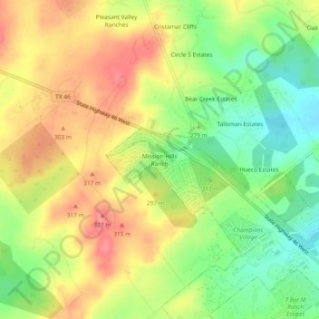
Name: Mission Hills Ranch topographic map, elevation, terrain.

Location: Mission Hills Ranch, New Braunfels, Comal County, Texas, 78132, United States (29.71701 -98.22717 29.75701 -98.18717)

Average elevation: 287 m

Minimum elevation: 246 m

Maximum elevation: 326 m

Other topographic maps

Click on a map to view its topography, its elevation and its terrain.

Gear up for your next adventure:

Smart Watches for Hiking - Track performance on trails
💳Travel Cards for Ireland - Convenient payment abroad
🛰️Handheld GPS Units - Professional satellite navigation for Irish highlands
🔭Portable Monoculars - One-handed optics for quick route checking
🧴Long-Lasting Sunscreen - Protect against UV rays during long days on the ridges

As an Amazon Associate, this site earns from qualifying purchases at no extra cost to you.