
South Toms River topographic map
Interactive map
Click on the map to display elevation.
About this map
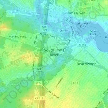
Name: South Toms River topographic map, elevation, terrain.
Location: South Toms River, Ocean County, New Jersey, United States (39.93227 -74.22638 39.95097 -74.18839)
Average elevation: 10 m
Minimum elevation: -2 m
Maximum elevation: 23 m
Other topographic maps
Click on a map to view its topography, its elevation and its terrain.
Big Thorofare
United States > New Jersey > Ocean County > Little Egg Harbor Township
Average elevation: 3 m