Geolocate

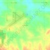
Lena topographic map

Click on the map to display elevation.

About this map

Name: Lena topographic map, elevation, terrain.

Location: Lena, Stephenson County, Illinois, 61048, United States (42.35697 -89.84078 42.39960 -89.79736)

Average elevation: 279 m

Minimum elevation: 238 m

Maximum elevation: 298 m

Other topographic maps

Click on a map to view its topography, its elevation and its terrain.
Gear up for your next adventure:

🎒Surveyor High-Vis Vests - Multi-pocket safety vests for field professionals
🔪Multi‑Tools & Knives - Versatile tools for outdoor tasks
🩰Hiking Binoculars - See long distances on trails
🔋Solar Power Banks - Keep your GPS and phone charged in the Irish wilderness
🧗Climbing Gear - Essential equipment for climbing routes

As an Amazon Associate, this site earns from qualifying purchases at no extra cost to you.