
Thank you for supporting this site ❤️
Make a donation
Make a donation
Gear up for your next adventure:
As an Amazon Associate, this site earns from qualifying purchases at no extra cost to you.
Frasdorf topographic map
Click on the map to display elevation.
Thank you for supporting this site ❤️
Make a donation
Make a donation
Gear up for your next adventure:
As an Amazon Associate, this site earns from qualifying purchases at no extra cost to you.
About this map
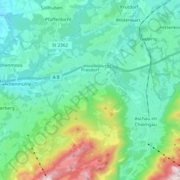
Name: Frasdorf topographic map, elevation, terrain.
Location: Frasdorf, Landkreis Rosenheim, Beieren, 83112, Duitsland (47.74722 12.23599 47.83732 12.34035)
Average elevation: 729 m
Minimum elevation: 497 m
Maximum elevation: 1,566 m
Thank you for supporting this site ❤️
Make a donation
Make a donation
Gear up for your next adventure:
As an Amazon Associate, this site earns from qualifying purchases at no extra cost to you.