
Cloghcor topographic map
Interactive map
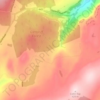
Click on the map to display elevation.
About this map
Name: Cloghcor topographic map, elevation, terrain.
Average elevation: 295 m
Minimum elevation: 35 m
Maximum elevation: 427 m
Other topographic maps
Click on a map to view its topography, its elevation and its terrain.
Cavehill
United Kingdom > Northern Ireland > Belfast
Cavehill, Belfast, County Antrim, Northern Ireland, BT36 7PN, United Kingdom
Average elevation: 169 m
Strangford Lough
United Kingdom > Northern Ireland > Belfast
Strangford Lough, Belfast, Northern Ireland, United Kingdom
Average elevation: 0 m
The Maidens
United Kingdom > Northern Ireland > Belfast
The Maidens, Belfast, Northern Ireland, United Kingdom
Average elevation: 0 m
Slemish
United Kingdom > Northern Ireland > Belfast
Slemish, Belfast, County Antrim, Northern Ireland, United Kingdom
Average elevation: 249 m